Log in
All resources
Create a design
Tools
7,171 Free Images of Atlas Map
bibliothèque nationale de france
maps of paris from bibliothèque nationale de france
turgot map of paris, bibliothèque nationale de france
joan blaeu
copper engraving print
british library
atlas novus (blaeu)
coats of arms on maps
1667 maps
atlas van loon
maps by willem and johannes blaeu
siege of breda 1624-1625
catalan atlas
mansa musa
1660s maps of spain
1667 maps
1660s maps of spain
1667 maps
1660s maps of spain
1667 maps
roman catholic archdiocese of salzburg
old maps of salzburg (state)
old maps of the kingdom of france (987-1792)
19th-century maps of the british isles
18th-century maps of korea
nouvel atlas de la chine
maps from university of amsterdam special collections
atlas der neederlanden
miniature speed atlas (1627) pieter van den keere
old county maps of cheshire
blaeu atlas of scotland 1654
coats of arms on maps
maps from university of amsterdam special collections
atlas der neederlanden
maps from university of amsterdam special collections
atlas der neederlanden
maps of uppland
1645 in sweden
old maps of dendermonde
atlas van loon
1573 maps of europe
christian sgrothen
miniature speed atlas (1627) pieter van den keere
old county maps of lincolnshire
old maps of arnemuiden
atlas van loon
maps by gerard valck
atlas beudeker
turgot map of paris, bibliothèque nationale de france
maps of paris from bibliothèque nationale de france
turgot map of paris, bibliothèque nationale de france
maps of paris from bibliothèque nationale de france
1640s maps of north rhine-westphalia
history of cologne
catalan atlas, 1959 reproduction
old maps of the sea of marmara
turgot map of paris, bibliothèque nationale de france
maps of paris from bibliothèque nationale de france
turgot map of paris, bibliothèque nationale de france
maps of paris from bibliothèque nationale de france
turgot map of paris, bibliothèque nationale de france
maps of paris from bibliothèque nationale de france
turgot map of paris, bibliothèque nationale de france
maps of paris from bibliothèque nationale de france
turgot map of paris, bibliothèque nationale de france
maps of paris from bibliothèque nationale de france
turgot map of paris, bibliothèque nationale de france
maps of paris from bibliothèque nationale de france
turgot map of paris, bibliothèque nationale de france
maps of paris from bibliothèque nationale de france
turgot map of paris, bibliothèque nationale de france
maps of paris from bibliothèque nationale de france
turgot map of paris, bibliothèque nationale de france
maps of paris from bibliothèque nationale de france
maps of the mamluk sultanate (cairo)
catalan atlas
old maps of the county of ravensberg
burg limberg
turgot map of paris, bibliothèque nationale de france
maps of paris from bibliothèque nationale de france
turgot map of paris, bibliothèque nationale de france
maps of paris from bibliothèque nationale de france
turgot map of paris, bibliothèque nationale de france
maps of paris from bibliothèque nationale de france
turgot map of paris, bibliothèque nationale de france
maps of paris from bibliothèque nationale de france
turgot map of paris, bibliothèque nationale de france
maps of paris from bibliothèque nationale de france
turgot map of paris, bibliothèque nationale de france
maps of paris from bibliothèque nationale de france
turgot map of paris, bibliothèque nationale de france
maps of paris from bibliothèque nationale de france
turgot map of paris, bibliothèque nationale de france
maps of paris from bibliothèque nationale de france
turgot map of paris, bibliothèque nationale de france
maps of paris from bibliothèque nationale de france
gemeente atlas van nederland - south holland
1860s maps of south holland
1640s maps of the netherlands
coats of arms on maps
atlas maior, vol 6 (scotland and ireland) - joan blaeu, 1667 - bl 114.h(star).6
1667 maps
gemeente atlas van nederland - south holland
maps of peursum
17th-century maps of silesia
coats of arms on maps
1660s maps of spain
1667 maps
novus atlas sinensis
old maps of sichuan
old maps of vlissingen
atlas van loon
gemeente atlas van nederland - south holland
maps of zoeterwoude
nicolas desmarest
ambroise tardieu
gemeente atlas van nederland - north holland
19th-century maps of amsterdam
17th-century maps of frankfurt am main
maps by willem and johannes blaeu
old maps of coevorden
atlas van loon
maps of paris from the david rumsey historical map collection
turgot map of paris, david rumsey historical map collection
daniel friedrich sotzmann
grosser deutscher atlas
old maps of regions of france
county of artois
maps of paris from the david rumsey historical map collection
maps of paris by caspar merian
old maps of roermond
upper guelders
maps of paris from bibliothèque nationale de france
proletarian literature
old maps of cities in switzerland
maps of biel/bienne
1370s maps of the balkans
catalan atlas
gemeente atlas van nederland - south holland
19th-century maps of rotterdam
history of tennessee
battle of belmont
17th-century maps of pomerania
coats of arms on maps
17th-century maps of pomerania
coats of arms on maps
old maps of french guiana
1630s maps of brazil
maps of territories in the burgundian circle
1645 maps of belgium
1800s maps of the world
old maps of the world
old maps of the canton of zürich
türlersee
atlas des anciens plans de paris by imprimerie nationale, 1880 from the musée carnavalet
maps of paris from paris musées
old maps of western pomerania
coats of arms on maps
maps of the electorate of cologne
coats of arms on maps
old maps of bredevoort
maps by isaak tirion
old maps of henan
maps with figures
maps of brazil by hendrik hondius
maps by willem and johannes blaeu
atlas maior, vol 12 (america) - joan blaeu, 1667 - bl 114.h(star).12
1667 maps of north america
gemeente atlas van nederland - south holland
1860s maps of south holland
gemeente atlas van nederland - south holland
old maps of katwijk, south holland
17th-century maps of herefordshire
old county maps of herefordshire
russian empire in thomas kitchen's general atlas (1773)
general atlas (1773)
1660s maps of spain
1667 maps
maps of antwerp by braun & hogenberg
maps of antwerp city walls
atlas geographico del reyno de españa e islas adjacentes (1757)
1757 maps of spain
atlas maior, vol 12 (america) - joan blaeu, 1667 - bl 114.h(star).12
1667 maps
maps of prince-bishopric of münster
prince-bishopric of osnabrück
old maps of culemborg
atlas van loon
1645 maps of belgium
ships on maps
miniature speed atlas (1627) pieter van den keere
old county maps of herefordshire
old maps of great britain
1250s maps
siege of lingen 1605
maps of lingen (ems)
atlas maior, vol 12 (america) - joan blaeu, 1667 - bl 114.h(star).12
1667 maps
atlas maior, vol 12 (america) - joan blaeu, 1667 - bl 114.h(star).12
1667 maps
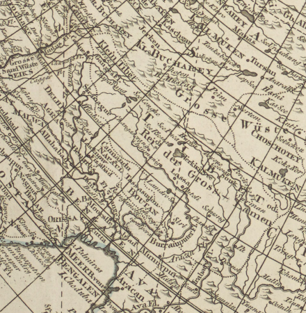
atlas maior, vol 11 (asia) - joan blaeu, 1667 - bl 114.h(star).11
1667 maps
atlas maior, vol 12 (america) - joan blaeu, 1667 - bl 114.h(star).12
1667 maps
atlas maior, vol 9 (italy) - joan blaeu, 1667 - bl 114.h(star).9
1667 maps of italy
maps by willem and johannes blaeu
1660s maps of the americas
old maps of sierra leone
1662 maps
1601 - 1700 of 7,171
Next page
/ 72